Wednesday, April 17, 2013

California Lighthouses 1

Piedras Blancas Lighthouse

The quiet cove at San Simeon was a bustling seaport in the late 1800s. Whaling was a huge industry and ships that plied the waters off the Central Coast brought their catch in to the San Simeon pier to offload to the Whaling Station there.

The whaling station was established near San Simeon in 1864 to surprise the huge creatures as they hugged the nearby shoreline during their annual migration. By the early 1870s, San Simeon Bay had also become a substantial port, as lumber, farm produce, and Cinnabar, an ore mined for its mercury, were exported from California's Central Coast. The real reason for building a lighthouse at Piedras Blancas, however, was not for local commerce but to serve the maritime traffic traveling up and down the California coast.

Juan Rodriguez Cabrillo noted the three prominent rocks just north of San Simeon in 1542 and named them Piedras Blancas, which means white rocks. Naturally, ships’ captains tried to be careful of them, but many ships met their doom after slamming into them. A light station at Point Piedras Blancas, just north of the bay, was needed.  In 1866, this location was chosen to fill the gap between the lighthouses at Point Conception and Point Pinos.  The Lighthouse is located on a rugged windswept point of land six miles north of Hearst Castle, along California’s scenic Highway One.

On April 25, 1874, material for the tower was landed through the surf at the point, and a crew of around thirty began work on the ornate tower. Leveling the rock on the point to accommodate the tower proved more difficult than expected as the rock was "so hard as almost to resist the best tempered drills." The conical tower had an inside diameter of twenty-four feet at its polygonal base and tapered to a diameter of just over twelve feet at the parapet.


The Piedras Blancas Lighthouse was completed in 1875 and a two story Victorian style dwelling was completed in 1876. The original tower was 100 feet tall and a housed a first-order Fresnel lens. The tower contains a circular iron stairway which reaches to the light.  A fog signal building and additional keeper's dwelling were added in 1905.  


Lighthouses in California were generally built on top of high cliffs. The tall imposing lighthouses common on the Atlantic coast were not necessary thanks to the California terrain. But at Piedras Blancas, a classic tall lighthouse was built and it is now one of only two like that in the state, Pigeon Point being the other.

The large, two-story, Lighthouse Keepers’ Victorian dwelling had twelve rooms, stood fifty feet northeast of the tower, and housed three keepers and their families, though it was only designed for two.
While the keepers now had comfortable accommodations, they still lacked one critical thing - water. When rainfall proved inadequate at filling the station's water tanks, water had to be purchased and hauled in at a considerable expense. After Congress appropriated $2,000, a well was sunk at the station, and a pump powered by a windmill was erected over it to help supply the station's water.

Stephen H. Morse was the first head keeper of the station, and he was succeeded by Captain Lorin Vincent Thorndyke in 1879. Thorndyke was a native of Maine, and, before accepting the assignment at Piedras Blancas, he had circumnavigated the globe five times and served at several other lighthouses in California. Keeper Thorndyke married Elizabeth Jarmon soon after arriving at the station, and two sons, Lorin, Jr. and Emory, were born to them at the lighthouse.

Lorin, Jr. recalls that during two or three summers in the 1880’s a schooner from San Francisco anchored off the white rocks near the station to harvest the deep covering of guano that had accumulated over the years. Men were transferred to the rocks in small boats where they would shovel the droppings into sacks, which were then transferred to the schooner. As one can easily imagine, Lorin remembers that a most offensive odor drifted over the station when the guano was disturbed.

In 1906 a fog signal building was built. Inside was the latest equipment to make sound loud enough to carry out to sea. 

Different fuels were used over the years to burn and produce the light. Oil and kerosene were two of them and these were kept in a small bunker just below the lighthouse and in front of the fog signal building. This bunker was constructed of concrete and is the first concrete building built in San Luis Obispo County. Light keepers and their assistants had to haul the oil or kerosene from the bunker up to the lighthouse and then ascend the winding staircase to the lens housing area.

In the hills southeast of the lighthouse, William Randolph Hearst started construction of his expansive castle in 1919. The Piedras Blancas Lighthouse was incorporated into a crest found above the entrance to the living room in Casa del Monte, one of three guest "cottages" located near the castle. Work on the castle continued until Hearst left San Simeon in 1947.

In 1949 the lens and the upper section of the structure were removed due to earthquake damage and a rotating aero-beacon replaced it. The present height of the lighthouse is 74 feet. The Fresnel lens was saved and is housed in an enclosure in downtown Cambria.

Piedras Blancas Light Station, which was once administered by the U.S. Lighthouse Service, and then the U.S. Coast Guard, is now managed by the Department of the Interior’s Bureau of Land Management. The BLM and the Piedras Blancas Light Station Association are restoring this historical site to its former glory.

The lighthouse grounds consist of fields full of native vegetation. For many years the area contained overgrown ice plant called capobrotus, the type seen along California freeways. Volunteers worked to pull this invasive plant out, but miraculously, the native vegetation began to return on its own. Docents have placed interpretive signs near the plants to benefit recognition.

Inside the lighthouse are displays explaining the early equipment used in operating the beacon. In the middle of the interior hangs a weighted pendulum that extends into an eight-foot hole in the floor. The pendulum swung and was part of the apparatus that made the beacon up top turn.

In the early days lighthouses were recognized by ships at sea during daylight hours by their special colors. Each lighthouse was assigned a specific set of colors and was painted accordingly. A ship passing by could tell where they were based on those colors. The ship’s captain could spy them through his looking glass and say, “Aha, white with black, we must be at Point Piedras Blancas.”

Recently the lighthouse was painted a bright white with dark trim. This removed the grime and rust stains that had been part of the façade for many years. Salt air takes its toll on buildings situated by the sea so five special coats of paint were applied to the lighthouse structure to protect it. The structure now more closely resembles what it looked like in its earliest days.

Volunteers have worked more than 100,000 hours restoring the lighthouse and surrounding buildings. The fuel oil house has been restored and a replica of the station’s shingled watch room has been completed. Other historic structures on the site have also been repaired. The next project slated to be done is to replicate the tower’s lantern room and although the Fresnel lens will not be moved back, this will have the lighthouse appearing exactly as it was when it was first built.

Tours of the light station are offered if you visit.


Just south of the lighthouse is a relatively new elephant seal colony. It is believed that overcrowding at other colonies prompted a group of seals to found the new colony around 1990. From an original population of just nineteen, the colony attracted approximately 10,000 seals in the year 2000.  Vicki and I took photos of them when we visited.

Thanks to several varieties of seals along with gulls, cormorants and other winged creatures, the rocks offshore from the lighthouse seem certain to retain the name of Piedras Blancas.


Oregon Lighthouses 1

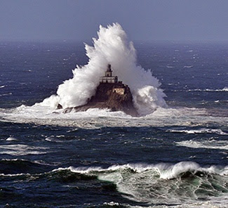
Tillamook Rock Lighthouse


The following is an account of the building of the lighthouse from LighthouseFriends.com.  It is so interesting I had to repeat it here:

”One mile west of Tillamook Head, a rock rises from the ocean. In the shape of a sea monster, it is where old Nor'easters go to die. Where Indians believed under ocean tunnels inhabited by spirits came to the surface. Where sheer cliffs drop straight into the sea to depths of 96 to 240 feet. Where clinging to the top, fighting off the gripping hands of the sea, stands a lighthouse. A symbol of the precarious line between human endeavor and the forces of nature.

“An intriguing and powerful testament of the will and determination of the human spirit, the story of Tillamook Rock Lighthouse began in 1879. Originally, it was hoped that a lighthouse could be built at Tillamook Head, a 1,000 foot high headland 20 miles south of the Columbia River. However, with its high elevation, fog often shrouded the top and its shear face offered no acceptable alternative.


In June 1879, a lighthouse engineer boated out to the rock to determine if a lighthouse there would be feasible. Though there were monstrous seas, and a landing was impossible, the engineer decided the rock could be conquered.

“The first surveyors accessed the site by jumping from a rocking boat onto the rock. On one attempt, master mason John R. Trewavas, who had a major role in the construction of a similar lighthouse on Wolf Rock off Land's End, England, made the trip to the rock with his assistant Cherry. In attempting a landing, Trewavas slipped and was swept into the churning sea. Cherry dove in after him, but couldn't find him. The boat was able to rescue Cherry, but Trewavas was never found.

“The locals, skittish of the project to begin with, raised an outcry over the foolhardiness of the endeavor. No local skilled workers could be found willing to work on the construction. Charles A. Ballantyne, who replaced Trewavas, hired men unfamiliar with the area and sequestered them in the Cape Disappointment keepers' quarters until construction could begin, in hopes the locals would not scare them away.

“On October 21, 1879, four laborers were put on the rock. The rest of the crew followed five days later. Putting men on the rock entailed stringing a 4 ½" line from the U.S. Revenue Cutter, Thomas Corwin, to the rock. The men would then use a "breeches buoy" to cross the line. With the cutter rolling and pitching in the swells, the line was never taut, and the transported fellow was often drug through the icy water.

“The first two weeks of construction found the crew totally exposed to the elements. Barren of caves, overhangs or ledges, the rock could not even provide minimal shelter. The workers chipped, chiseled, and blasted away. And then it hit.  January 2, 1880. A dying Nor'easter. The seas crashed above the crest of the rock. Rocks flew as breakers tore off chunks of the rock and tossed them at will. The perilous storm pounded the rock. The storehouse was swept away taking most of their tools and provisions. Then the water tank, the traveler line and the roof of the blacksmith shop were ripped away. Clinging on for life, the men stayed in their shelter, the safest place on the rock. Hungry, soaked, and with no place to go.

“The Corwin was finally able to approach the rock 16 days after the storm began. All of the workmen were alive but in dire circumstances. The traveler line was set up again, this time using a kite to transport it to the rock. Food, supplies and clothing were again in the hands of the workers.

“By May 31st 1880, 224 days into construction, the hump of the rock had been leveled and construction of the lighthouse began.  All materials for the lighthouse were brought by boat and hauled up the rock by derricks. The structure originally was a one-story room, 48 x 45 feet with a 32 x 28 extension for the fog signal equipment. Later a half story was added. A 16-foot square tower rising from the center of the building supports the lantern room and parapet, which housed a first-order Fresnel lens. The light shown 133 feet above the sea with a signature of a white flash every five seconds.

“After a total of 525 days of labor, the lighthouse was lit for the first time on January 21, 1881. Amazingly, the only construction death was the drowning of Trewavas.

“Soon the reputation of the lighthouse spread from coast to coast, not only known as an engineering triumph, but also as a challenging assignment for even the most stalwart keeper. Nicknamed "Terrible Tilly", it lived up to its name.

“Originally, a keeper assigned to the rock spent three months on and two weeks off. Four keepers were always on the rock. The assignment was changed to 42 days on 21 off, because conditions proved extremely harsh on both the physical and mental stability of the keepers.

“The cramped quarters, frequent storms, and fog with the ensuing blasting of the fog sirens, often caused tension among the crew. Enraged keepers were known to pass notes at dinnertime rather than speak to each other. Any keeper causing trouble or showing mental instability was immediately transferred from the rock. The newspapers loved the drama, and any dismissal raised their eyebrows. One reported that Keeper Bjorling was removed quickly from his post after trying to kill the headkeeper by putting ground glass in his food.

Photo from: Lighthouse Friends.com
“October 21, 1934 brought the worst tempest on record. The entire Pacific Northwest was inundated with a fierce and battering storm. No one felt it more than the four keepers at Terrible Tilly. The sea spewed boulders through the lantern room, smashing the Fresnel lens. Iron bolts anchored into the rock 3 feet deep were ripped out. Seawater flowed like a waterfall down the tower into the rotunda. Some areas of the lighthouse were neck high in water. All communication to the mainland was lost. The keepers worked feverishly in knee-deep water trying to set up an auxiliary light, but no light would shine that night.

"For only one night of the four-day storm were mariners left without the beacon. Heroically, the auxiliary light was beaming the second night. A makeshift short wave radio made contact with a ham radio operator in Seaside, and the world heard the keepers had survived. All were commended for their exceptional attention to duty through the most trying conditions.

”The Fresnel lens was never replaced.

“Terrible Tilly shone her light for 77 years before being replaced by a red whistle buoy, anchored one mile seaward of the rock. On September 1, 1957, Keeper Oswald Allik, who had served twenty years at the station, turned off the light, and penned the following final entry in the logbook, which today is on display at the Columbia River Maritime Museum in Astoria, Oregon:
     ““Farewell, Tillamook Rock Light Station. An era has ended. With this final entry, and not without sentiment, I return thee to the elements. You, one of the most notorious and yet fascinating of the sea-swept sentinels in the world; long the friend of the tempest-tossed mariner. Through howling gale, thick fog and driving rain your beacon has been a star of hope and your foghorn a voice of encouragement. May the elements of nature be kind to you. For 77 years you have beamed your light across desolate acres of ocean. Keepers have come and gone; men lived and died; but you were faithful to the end. May your sunset years be good years. Your purpose is now only a symbol, but the lives you have saved and the service you have rendered are worthy of the highest respect. A protector of life and property to all, may old-timers, newcomers and travelers along the way pause from the shore in memory of your humanitarian role.””

“Tillamook Lighthouse was purchased by five men from Las Vegas at a bid sale in 1959 for $5,600. Three of the men visited the lighthouse a few weeks after the purchase, but it is believed they never again set foot on the rock or funded any improvements. In 1973, George Hupman, a New York-based executive with General Electric, purchased the lighthouse from the Las Vegas combine for $11,000 partly to retain ties to Oregon, where his family had lived for two years in the late 1960s.

“The lighthouse was again sold in 1980 to Mimi Morissette and Cathy Riley, both real estate developers, and a group of investors for $50,0000. Under Morissette's direction, the structure was gutted and turned into the Eternity at Sea Columbarium. Interested parties could then have their ashes placed inside the lighthouse, with prices varying from $1,000 for a place in the derrick room to $5,000 for a prime spot in the lantern room. ““With an estimated capacity of a few hundred thousand remains, the lighthouse seemed to be not only a self-sustaining project but a profitable business opportunity.””

"The owners of the lighthouse lost their license to operate as a columbarium in 1999 when they were late with their renewal. In 2005, an application for a new license was rejected due to inaccurate record keeping and improper storage of urns. Addressing concerns that urns are not well protected, Morissette, whose parents are inurned at the lighthouse, said, ““People ask me what if a tsunami hits the lighthouse, and I tell every person their second choice better be to be buried at sea.””

“Eternity at Sea still plans to raise additional money and construct niches in titanium to store some 300,000 urns. To date, only about thirty urns have been placed in the lighthouse, and two of those were reported stolen by vandals in 1991.

“The ghostly looking structure, now with perhaps more than its own story to tell, is listed on the National Register of Historic Places.”

Here is another little tidbit from wikipedia:  

The wreck of the Lupatia

In early January of 1881, when the lighthouse was near completion, the barque Lupatia was sailing in thick fog and high winds when the ship's Captain noticed that they were too close to shore. Wheeler, the official in charge of the lighthouse's construction, heard the voices of the panicked crew and immediately ordered his men to place lanterns in the tower, and light a bonfire to signal the ship that they were approximately 600 feet from the rock. The ship appeared to have been able to turn itself toward returning to sea, however quickly disappeared into the fog, and Wheeler was not able to hear the crew. The next day, the bodies of all 16 crew members were found washed up on shore of Tillamook Head. The only survivor of the wreck was the crew's dog.
Wikipedia's information came from the Cannon Beach Gazette.

Monday, November 26, 2012

Maine Fall Color 3 - Fort Kent - Aroostook War

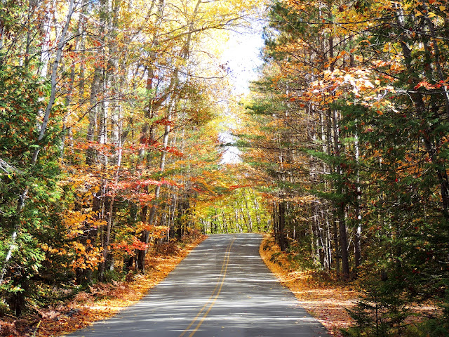
After leaving Baxter State Park, we headed up the face of Maine to his pate (when looking at the map) at Fort Kent. Along the road we scored some more great fall color shots:


When we arrived at the northern most point of Highway 11 in Maine we came to the start of U.S. 1 which winds its way down the eastern coastline all the way to Florida.  Below is the sign indicating the start of the highway and also a photo of the end (or beginning, if you are headed north) of the the highway.


We stopped by Fort Kent, itself which was built during the bloodless Aroostook war:  


The Fort Kent Blockhouse is located at the confluence of the Fish River and the St. John River in Fort Kent, Maine. The blockhouse is the only fortification relating to the "Bloodless" Aroostook War of 1838-1839, and the border dispute between Great Britain and the United States. 

The blockhouse is a two-story structure. Its walls are built of square-hewn cedar logs, some of which measure over 19 inches in width. It is an excellent example of early 19th-century military architecture.

The Aroostook War (sometimes called the Pork and Beans War) was an undeclared nonviolent confrontation between the United States and the United Kingdom over the international boundary between British North America (Canada) and Maine. The compromise resolution won a mutually accepted border between the state of Maine and the provinces of New Brunswick and Quebec. High tensions and heated rhetoric in Maine and New Brunswick led both sides to raise troops, arm them, and march them to the disputed border. President Martin Van Buren sent Brigadier General Winfield to work out a compromise. The compromise created a neutral area, and the excitement faded away as the diplomats took over.  The War involved no actual confrontation between military forces, and negotiations between diplomats from the UK and United States quickly settled the dispute.

The signing of the Webster - Ashburton Treaty in 1842 settled this boundary dispute between Maine and New Brunswick and reduced the need for a fort, giving most of the disputed area to Maine and a militarily vital connection between Canadian provinces to the UK.  However, Federal troops remained there until 1845 to protect Maine’s and the United States’ interests in the region.

The blockhouse now is a museum and is maintained by local Eagle Scouts in cooperation with the Bureau of Parks and Recreation, Maine Department of Conservation. The state-owned blockhouse is on the National Register of Historic Places as well as being a National Historic Landmark.

Tuesday, November 20, 2012

Maine Fall Color 2

Baxter State Park

On Tues, we were going to head out to Acadia National Park, but we heard on the news that it was going to be quite windy and we were afraid that if we did we might miss the peak of the fall color with all the leaves having blown off the trees.  So, we decided to go inland, first, where it had been colder, bringing out more color than was on the coast.  We headed north to Baxter State Park and then to the the face of Maine's pate (when looking at the map) and then down the flat side of his forehead back to Bangor.  We would save Acadia National Park and Bar Harbor for Wednesday.  

Baxter State Park
Photo by:  Cherri
This first photograph is of the color we found just outside the park itself, since there are no paved roads inside the park.  I guess we timed it about right!

West Side of the Park

"After the Fall"

The park is a large wilderness area permanently preserved as a state park, located in in north-central Maine. It was a gift to the people of Maine established from donations of land from Governor Percival P. Baxter, creating a Park of over 200,000 acres in size. 
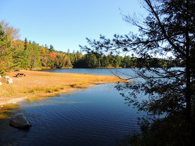
Baxter State Park Kidney Pond
Kidney Pond

 
Duck Lunch - Bottoms Up!
Baxter Park is not part of the Maine State Park system. It is governed by the Baxter State Park Authority, consisting of the Maine Attorney General, the Maine Commissioner of Inland Fisheries and Wildlife and the Director of the Maine Forest Service. The Park is independently funded through a combination of revenues from trusts, user fees and the sale of forest products from the Park's Scientific Forest Management Area. 


The park is home to the state's highest peak, Katahdin which is a cluster of mountains.  It has many bodies of water and streams and is a great place for families to visit.  


Rock Formation within the Park
There are no stores or gas stations inside the park. Access and use are strictly regulated in accordance with Gov. Baxter's expressed desire to keep the Park "forever wild."  He has made the following quote, "Man is born to die, his work short lived; buildings crumble, monuments decay, wealth vanishes, but Katahdin, in all it's glory, shall forever remain the mountain of the people of Maine. Throughout the ages it will stand as an inspiration to the men and women of the state."

Friday, November 9, 2012

Maine Fishing Villages 2

After leaving Campobello and the West Quoddy Head light, we headed south along the Maine coastline to our room in Bangor. 

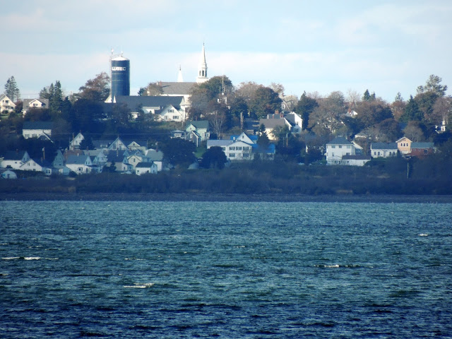
Our first stop was this shot of Lubec across the Channel:
Lubec
Photo by:  Cherri

Continuing south on Hwy 191, we arrived in Cutler, ME. 
Cutler
Photo by:  Cherri
I really enjoyed taking this shot of a dock stretching out into the harbor.  
Dock at Cutler, Maine
Photo by:  Cherri


The final place we visited, just before dark was Jonesport on Hwy 187.  As you can see, we strayed off Maine Hwy 1 to meander down the coastline as much as possible.


The next day, we headed to Bar Harbor, Acadia National Park and a momentous question.

Thursday, November 8, 2012

Maine Lighthouses 7

Lubec Channel Light
Photo by:  Cherri

Bruce and I were driving to visit West Quoddy light when we spied this one from the road across a farmer's field.  I hopped out and took a quick shot of it, but had to do some research to determine which light it was.

Built in 1890, this light is on the west side of the Lubec channel.  It is often referred to as the "Spark Plug."  See any resemblance?

The base of the light is a cylindrical iron caisson 33 feet in diameter and 48 feet high A fifth order Fresnel lens was installed in the lantern with a white flash every 15  seconds from 61 feet above sea level.  The superstructure was painted brown until 1903, when it was repainted white.  There were once miniature brass lighthouses on on each baluster of the gallery, but have since been removed. The tower contained five levels, two of which were living quarters for the keepers.  The lower deck was a combination living room and kitchen The next deck was a bedroom.

Here is an interesting story about one of the keepers:  
 
Elson Small, who went on to a 28-year career at several stations, became the assistant keeper in November 1920, weeks before he married Loring Myers’s, his co-keeper's niece, Constance “Connie” Scovill. Myers and Small alternated two-day stays at the lighthouse.

When 19-year-old Connie went with her husband to visit the lighthouse for the first time, she was intimidated by the idea of climbing the 30-foot ladder. In her book, The Lighthouse Keeper’s Wife, she later wrote:

I had been afraid of boats and the sea since a cousin teasingly rocked a rowboat we were in when I was three years old. I never learned to row until after I married Elson. I was also afraid of heights, but trying not to show just how scared I was, I said to Elson, “I can never climb up there."

"Oh yes, you can. Just grab the rungs and I’ll be right behind you.”
So, with him behind me telling me to look up and never down, I made it. To this day I have kept his words with me and when I’d get discouraged I would think of them. They’ve helped me a good many times to overcome a panicky feeling and do what had to be done.

There are other stories about some of the keepers at the following website:
.
In 1989 the light was to be discontinued, but local residents mounted a "Save the Sparkplug" campaign. Automobile sparkplugs were handed out to gain attention for the cause. In 1992, a $700,000 renovation restored Lubec Channel Light to its best condition in decades. 

I'm glad we didn't miss this one!


Maine Lighthouses 6


West Quoddy Head Light 
 
West Quoddy Head Light
Photo by:  Cherri
Located on the easternmost point of the continental United States, the red and white stripped lighthouse marks the southwest entrance to Quoddy ChannelWhy West Quoddy, you say, if it is the easternmost point?  There is an East Quoddy Light Station in New Brunswick on Campobello Island that is slightly north and to the east.

Photo by:  Cherri
Originally built of rubblestone in 1808 by order of Thomas Jefferson, the lighthouse received one of the nation's first fog bells in 1820.  The keeper was required to strike the bell by hand in foggy weather, a frequent occurrence in the nearby Bay of Fundy.  For his trouble, in 1827 Congress allotted the keeper and additional $60 annually.

The present 49' brick tower was erected in 1858, a one and a half story keeper's house was built and a third order Fresnel lens was installed.  In 1869 a trumpet fog whistle replaced the earlier bells, allowing the keeper to get a little more sleep.

The light was automated in 1988 and is now part of Quoddy Head State Park.