Monday, November 26, 2012

Maine Fall Color 3 - Fort Kent - Aroostook War

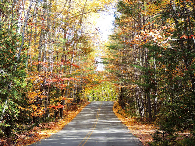
After leaving Baxter State Park, we headed up the face of Maine to his pate (when looking at the map) at Fort Kent. Along the road we scored some more great fall color shots:


When we arrived at the northern most point of Highway 11 in Maine we came to the start of U.S. 1 which winds its way down the eastern coastline all the way to Florida.  Below is the sign indicating the start of the highway and also a photo of the end (or beginning, if you are headed north) of the the highway.


We stopped by Fort Kent, itself which was built during the bloodless Aroostook war:  


The Fort Kent Blockhouse is located at the confluence of the Fish River and the St. John River in Fort Kent, Maine. The blockhouse is the only fortification relating to the "Bloodless" Aroostook War of 1838-1839, and the border dispute between Great Britain and the United States. 

The blockhouse is a two-story structure. Its walls are built of square-hewn cedar logs, some of which measure over 19 inches in width. It is an excellent example of early 19th-century military architecture.

The Aroostook War (sometimes called the Pork and Beans War) was an undeclared nonviolent confrontation between the United States and the United Kingdom over the international boundary between British North America (Canada) and Maine. The compromise resolution won a mutually accepted border between the state of Maine and the provinces of New Brunswick and Quebec. High tensions and heated rhetoric in Maine and New Brunswick led both sides to raise troops, arm them, and march them to the disputed border. President Martin Van Buren sent Brigadier General Winfield to work out a compromise. The compromise created a neutral area, and the excitement faded away as the diplomats took over.  The War involved no actual confrontation between military forces, and negotiations between diplomats from the UK and United States quickly settled the dispute.

The signing of the Webster - Ashburton Treaty in 1842 settled this boundary dispute between Maine and New Brunswick and reduced the need for a fort, giving most of the disputed area to Maine and a militarily vital connection between Canadian provinces to the UK.  However, Federal troops remained there until 1845 to protect Maine’s and the United States’ interests in the region.

The blockhouse now is a museum and is maintained by local Eagle Scouts in cooperation with the Bureau of Parks and Recreation, Maine Department of Conservation. The state-owned blockhouse is on the National Register of Historic Places as well as being a National Historic Landmark.

Tuesday, November 20, 2012

Maine Fall Color 2

Baxter State Park

On Tues, we were going to head out to Acadia National Park, but we heard on the news that it was going to be quite windy and we were afraid that if we did we might miss the peak of the fall color with all the leaves having blown off the trees.  So, we decided to go inland, first, where it had been colder, bringing out more color than was on the coast.  We headed north to Baxter State Park and then to the the face of Maine's pate (when looking at the map) and then down the flat side of his forehead back to Bangor.  We would save Acadia National Park and Bar Harbor for Wednesday.  

Baxter State Park
Photo by:  Cherri
This first photograph is of the color we found just outside the park itself, since there are no paved roads inside the park.  I guess we timed it about right!

West Side of the Park

"After the Fall"

The park is a large wilderness area permanently preserved as a state park, located in in north-central Maine. It was a gift to the people of Maine established from donations of land from Governor Percival P. Baxter, creating a Park of over 200,000 acres in size. 
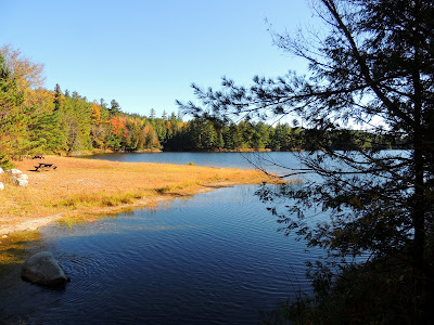
Baxter State Park Kidney Pond
Kidney Pond

 
Duck Lunch - Bottoms Up!
Baxter Park is not part of the Maine State Park system. It is governed by the Baxter State Park Authority, consisting of the Maine Attorney General, the Maine Commissioner of Inland Fisheries and Wildlife and the Director of the Maine Forest Service. The Park is independently funded through a combination of revenues from trusts, user fees and the sale of forest products from the Park's Scientific Forest Management Area. 


The park is home to the state's highest peak, Katahdin which is a cluster of mountains.  It has many bodies of water and streams and is a great place for families to visit.  


Rock Formation within the Park
There are no stores or gas stations inside the park. Access and use are strictly regulated in accordance with Gov. Baxter's expressed desire to keep the Park "forever wild."  He has made the following quote, "Man is born to die, his work short lived; buildings crumble, monuments decay, wealth vanishes, but Katahdin, in all it's glory, shall forever remain the mountain of the people of Maine. Throughout the ages it will stand as an inspiration to the men and women of the state."

Friday, November 9, 2012

Maine Fishing Villages 2

After leaving Campobello and the West Quoddy Head light, we headed south along the Maine coastline to our room in Bangor. 

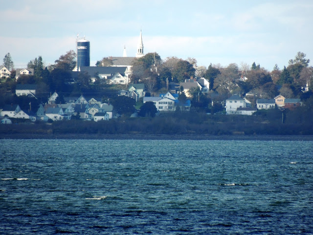
Our first stop was this shot of Lubec across the Channel:
Lubec
Photo by:  Cherri

Continuing south on Hwy 191, we arrived in Cutler, ME. 
Cutler
Photo by:  Cherri
I really enjoyed taking this shot of a dock stretching out into the harbor.  
Dock at Cutler, Maine
Photo by:  Cherri


The final place we visited, just before dark was Jonesport on Hwy 187.  As you can see, we strayed off Maine Hwy 1 to meander down the coastline as much as possible.


The next day, we headed to Bar Harbor, Acadia National Park and a momentous question.

Thursday, November 8, 2012

Maine Lighthouses 7

Lubec Channel Light
Photo by:  Cherri

Bruce and I were driving to visit West Quoddy light when we spied this one from the road across a farmer's field.  I hopped out and took a quick shot of it, but had to do some research to determine which light it was.

Built in 1890, this light is on the west side of the Lubec channel.  It is often referred to as the "Spark Plug."  See any resemblance?

The base of the light is a cylindrical iron caisson 33 feet in diameter and 48 feet high A fifth order Fresnel lens was installed in the lantern with a white flash every 15  seconds from 61 feet above sea level.  The superstructure was painted brown until 1903, when it was repainted white.  There were once miniature brass lighthouses on on each baluster of the gallery, but have since been removed. The tower contained five levels, two of which were living quarters for the keepers.  The lower deck was a combination living room and kitchen The next deck was a bedroom.

Here is an interesting story about one of the keepers:  
 
Elson Small, who went on to a 28-year career at several stations, became the assistant keeper in November 1920, weeks before he married Loring Myers’s, his co-keeper's niece, Constance “Connie” Scovill. Myers and Small alternated two-day stays at the lighthouse.

When 19-year-old Connie went with her husband to visit the lighthouse for the first time, she was intimidated by the idea of climbing the 30-foot ladder. In her book, The Lighthouse Keeper’s Wife, she later wrote:

I had been afraid of boats and the sea since a cousin teasingly rocked a rowboat we were in when I was three years old. I never learned to row until after I married Elson. I was also afraid of heights, but trying not to show just how scared I was, I said to Elson, “I can never climb up there."

"Oh yes, you can. Just grab the rungs and I’ll be right behind you.”
So, with him behind me telling me to look up and never down, I made it. To this day I have kept his words with me and when I’d get discouraged I would think of them. They’ve helped me a good many times to overcome a panicky feeling and do what had to be done.

There are other stories about some of the keepers at the following website:
.
In 1989 the light was to be discontinued, but local residents mounted a "Save the Sparkplug" campaign. Automobile sparkplugs were handed out to gain attention for the cause. In 1992, a $700,000 renovation restored Lubec Channel Light to its best condition in decades. 

I'm glad we didn't miss this one!


Maine Lighthouses 6


West Quoddy Head Light 
 
West Quoddy Head Light
Photo by:  Cherri
Located on the easternmost point of the continental United States, the red and white stripped lighthouse marks the southwest entrance to Quoddy ChannelWhy West Quoddy, you say, if it is the easternmost point?  There is an East Quoddy Light Station in New Brunswick on Campobello Island that is slightly north and to the east.

Photo by:  Cherri
Originally built of rubblestone in 1808 by order of Thomas Jefferson, the lighthouse received one of the nation's first fog bells in 1820.  The keeper was required to strike the bell by hand in foggy weather, a frequent occurrence in the nearby Bay of Fundy.  For his trouble, in 1827 Congress allotted the keeper and additional $60 annually.

The present 49' brick tower was erected in 1858, a one and a half story keeper's house was built and a third order Fresnel lens was installed.  In 1869 a trumpet fog whistle replaced the earlier bells, allowing the keeper to get a little more sleep.

The light was automated in 1988 and is now part of Quoddy Head State Park.


East Quoddy Lighthouse, NB

East Quoddy Head Light
(Head Harbour Light)

aka Head Harbor Light in NB


The lightstation at Head Harbour, one of the oldest lightstations in Canada is located on the northern extremity of Campobello Island, which is the largest island in the area of Passamaquoddy Bay near the Maine-New Brunswick border.  This light is known locally as "Head Harbor Light." Campobello Island is closer to the coast of Maine than it is to the mainland of New Brunswick.  Its road link with the Canadian mainland is across the Franklin Delano Roosevelt Bridge to Lubec, Maine and then a 60 mile drive to St. Stephens in Canada.

By the 1820s, trade was flourishing and traffic grew between Campobello Island and the Maine Coast. Fishing, shipping, and shipbuilding were very important activities in Passamaquoddy Bay, but the famous Fundy fogs, high tides, and treacherous rocks around Campobello Island were a threat to these industries. Head Harbour's light was the first Canadian response to this danger, built in 1829 to warn sailors approaching the craggy rocks and shoals around Campobello Island.

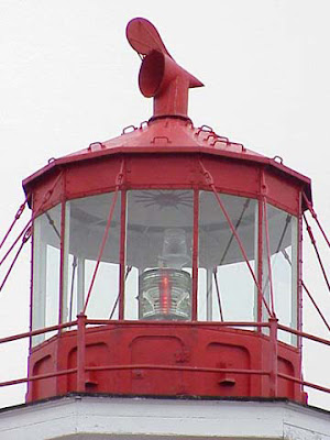
Detail of East Quoddy Light Lantern Room

Lantern Room detail

Today, the waterways in the region are still busy and the natural hazards to navigation have not diminished.  180 years later the light continues to provide an essential service to the marine community in the area.

The rocky outcropping on which the station is set becomes an island at high tide.  The station is accessible by foot at low tide.

The light tower is a white wood, shingle-clad, tapered octagonal structure about 51" in height .  The original lantern was replaced by the present cast iron model in 1887.  The red cross has been on the tower at least since Confederation to distinguish the tower from windrows of snow in late winter and early spring.  Photos of the station show that it has remained fundamentally unchanged since at least 1902.

The Head Harbour Light is now fully automated and no keeper is in residence.


Campobello, NB

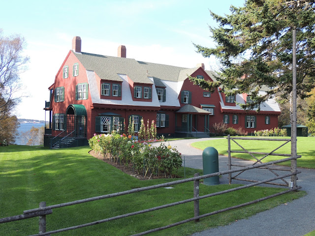
After leaving Eastport, we had to backtrack across a series of small islands connected by bridges and causeways to Highway 1.  From there we headed to Lubec, the easternmost point in the United States, so that we could visit President Franklin Roosevelt's boyhood summer home, Campobello.  The home is actually located on a New Brunswick island off the coast of Maine.  You cross the Franklin Delano Roosevelt Bridge to reach the island and the Roosevelt Campobello International Park.  This park is the only one of its kind because it is run by both the Canadian and American governments, even though the park is located in Canadian territory. 

President Franklin Roosevelt's Summer Home
Photo by:  Cherri

Roosevelt House and Museum

Kale Garden and FDR Shield on doorway of museum.  Notice the house in background.
Roosevelt's summer home

Campobello always relied heavily on fishing as the mainstay of the island economy; however, the Passamaquoddy Bay region's potential for tourism was realized about the time Bar Harbor was beginning to develop. Campobello Island became home to a similar, although much smaller and more exclusive, development following the acquisition of some island properties by several private American investors. A luxurious resort hotel was built and the island became a popular summer colony for wealthy Canadians and Americans, many of whom built grand estates there.

Included in this group were Sara Delano and her husband James Roosevelt, Sr from New York. Sara Delano had a number of Delano cousins living in Maine, and Campobello offered a beautiful summer retreat from the New York weather, where their family members could easily visit. From 1883 onward, the Roosevelt family made Campobello Island their summer home. 

Their son, Franklin D. Roosevelt, future President of the United States, would spend his summers on Campobello from the age of one.  Loving the island and remembering his youth sailing on the nearby Bay of Fundy, Roosevelt acquired a larger property and built a 34-room "cottage," which he would use as a summer retreat until 1939. It was here that Franklin D. Roosevelt, Jr., was born in August 1914. 

It was at Campobello, in August 1921, that the future president fell ill with polio, which resulted in his permanent paralysis from the waist down. Roosevelt did strive for seven years to try to regain use of his legs but never again walked unassisted.

Today Roosevelt Campobello International Park serves as a memorial to FDR and a symbol of cooperation between the U.S. and Canada.

Wednesday, November 7, 2012

Maine Fishing Villages

After coming up Highway 9 in Maine, going northeast, we arrived at the bridge of the nose on the face of Maine, at the St Croix River.  Here we were able to look across the river into St Stephens, New Brunswick.

Across the St Croix River
Photo by:  Cherri

While standing on the side of the road on Hwy 1, I took this picture of some wildflowers at my feet:


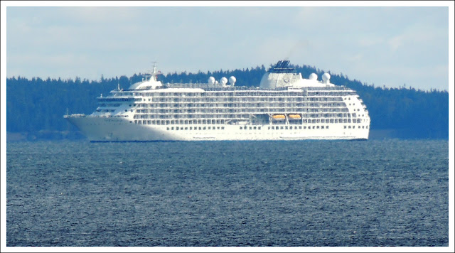
Looking out across the water to the New Brunswick side, we saw a huge cruise ship which turns out to be The World.  This is a ship of floating luxury condominiums, all privately owned.  Nothing like seeing the world without ever having to leave the comfort of home.

St Croix River, New Brunswick
Photo by:  Cherri
Wonder what it would be like to live aboard this ship?  Here is a quick little video about what life is like aboard the ship:  http://aboardtheworld.com/video.htm

We encountered this ship again, the next day at Bar Harbor and I'll have a little bit more information about it on that post.

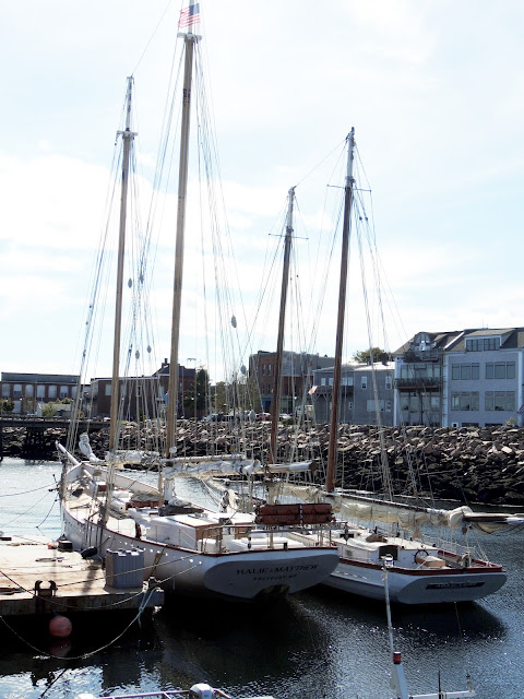
Here is a photo of the harbor at Eastport, Maine:

Ships in Harbor
Photo by:  Cherri


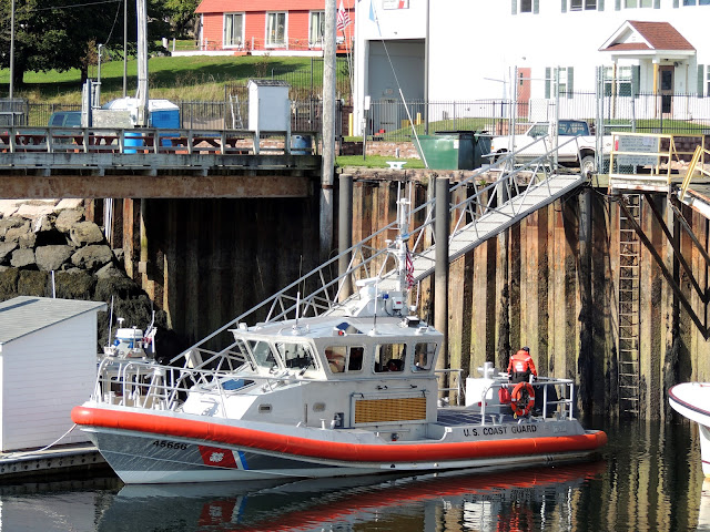
This is a Coast Guard boat in from of the station at Eastport:

Coast Guard boat 
Photo by:  Cherri
That afternoon we continued around a loop on Hwy 1, eventually ending back in Bangor.  Tomorrow I will post photos of the West Quoddy Head Light east of Lubec and President Franklin Roosevelt's summer home on Campobello, New Brunswick.

Monday, November 5, 2012

Maine Fall Color 1

On our second day in Maine, Bruce and I went in search of "Fall Color."  The trees along the coast had not yet completely turned so we headed inland.  We drove up Highway 9, northeast toward New Brunswick.  

If the map of Maine is a person in profile, we drove to his nose and then back south along the coast 'til we headed inland back to Bangor. We visited Campobello in New Bruswick and then more lighthouses and fishing villages along the coast.   We "tickled Maine's mustache" as we came back south.  I will be posting these photos soon.

Today, I'm sharing some of the colorful leaves as we headed northeast.
Hwy 9
Photo by:  Cherri
 Bruce particularly likes the color here in Maine.  It is interspersed with Evergreen trees and he feels it makes it more interesting.  We have similar fall color in the Pacific Northwest.
Along Hwy 9
Photo by:  Cherri
 Another shot of this stream running along highway:
Stream along Hwy 9
Photo by:  Cherri
All the trees had not yet turned, but the weather report was projecting cold weather that night.  Unfortunately, they were also projecting wind, which could blow the leaves off the trees.  The next day we headed into Maine's North Woods to see what we could find.


Here is a video of the above river.  Bear in mind that I'm new at taking videos.  I promise I'll improve.

Sunday, November 4, 2012

Maine Fishing Villages

Toward the end of our first day driving, we took these photos of a couple of Maine's picturesque fishing villages.

Rockland, ME
Rockland, ME
Photo by:  Cherri

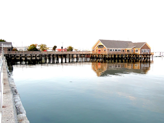
The Pearl Restaurant on a pier at Rockland, ME

Rockland, ME The Pearl Restaurant
Photo by:  Cherri

As night was falling we found ourselves here: 
 
 Camden Harbor

Camden Harbor
Photo by:  Cherri